
Sign in to which Dashivo?
Your own phones, or your company's fleet. Each has its own account.
New to Dashivo Pro? Talk to us and we'll set up your company.
HUD & speed limits
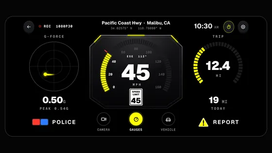
Your speed, the posted limit, G-force, rotation and where you are.
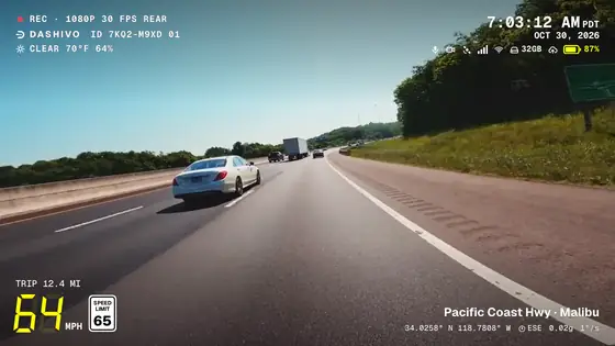
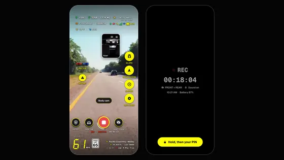
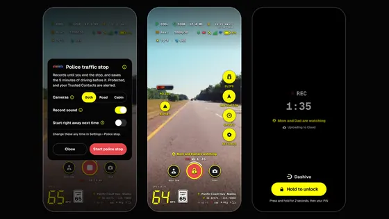
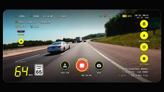
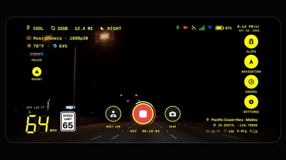
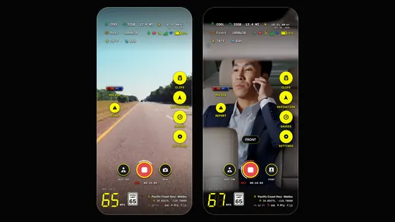
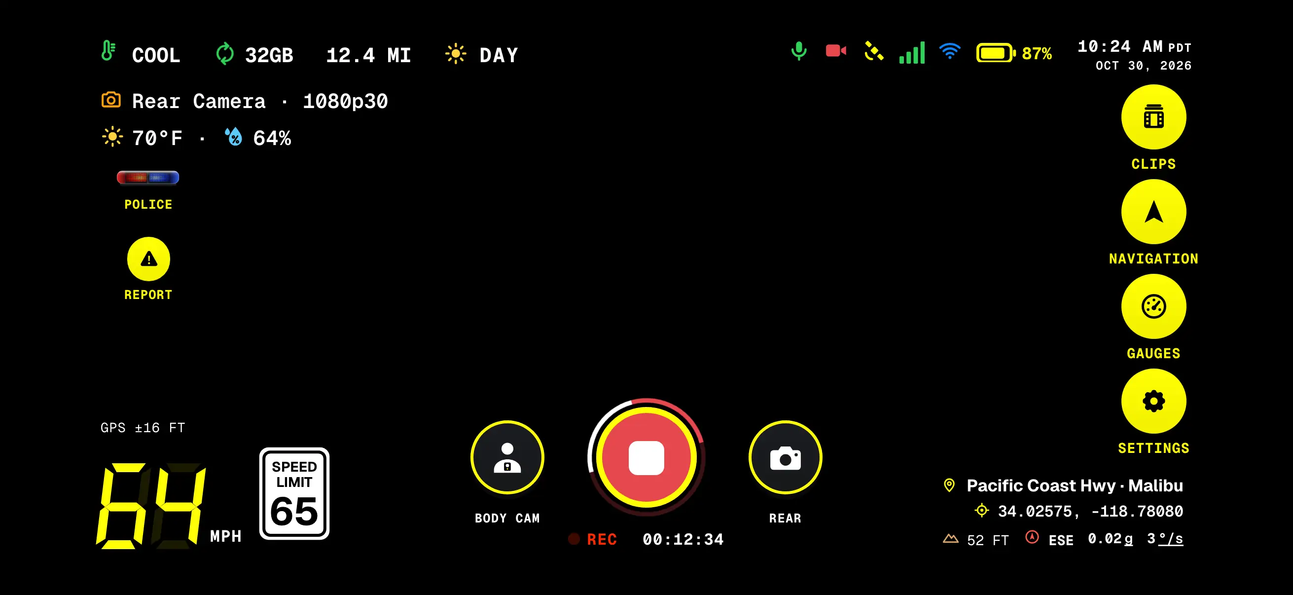
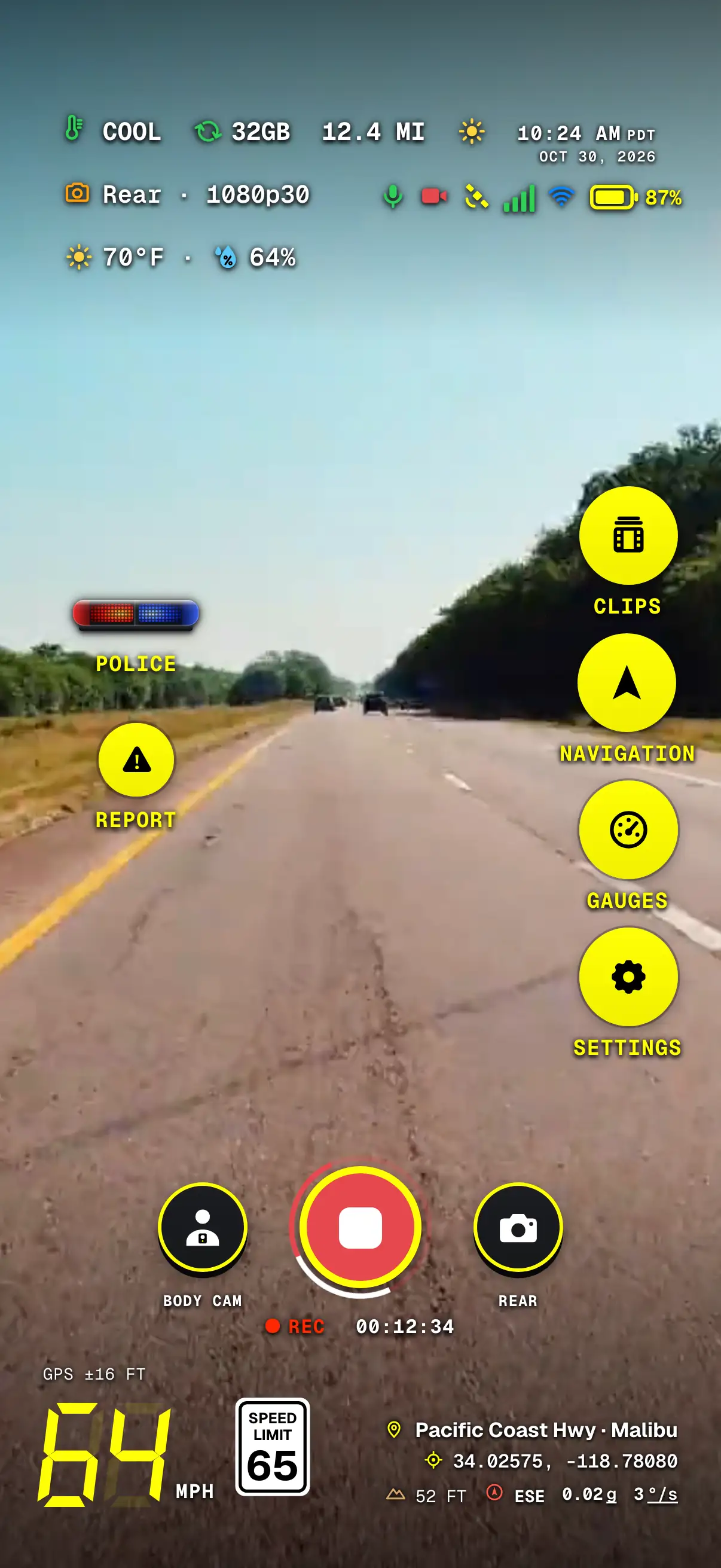
Everything Dashivo™ knows while you drive sits around the edge of the picture: your speed with the posted limit beside it, this trip, the street and city with the coordinates, G-force and the rotation rate in °/s, the clock, the weather and the phone's own status. The HUD is for you and is never recorded; the stamp carries the facts into the video.
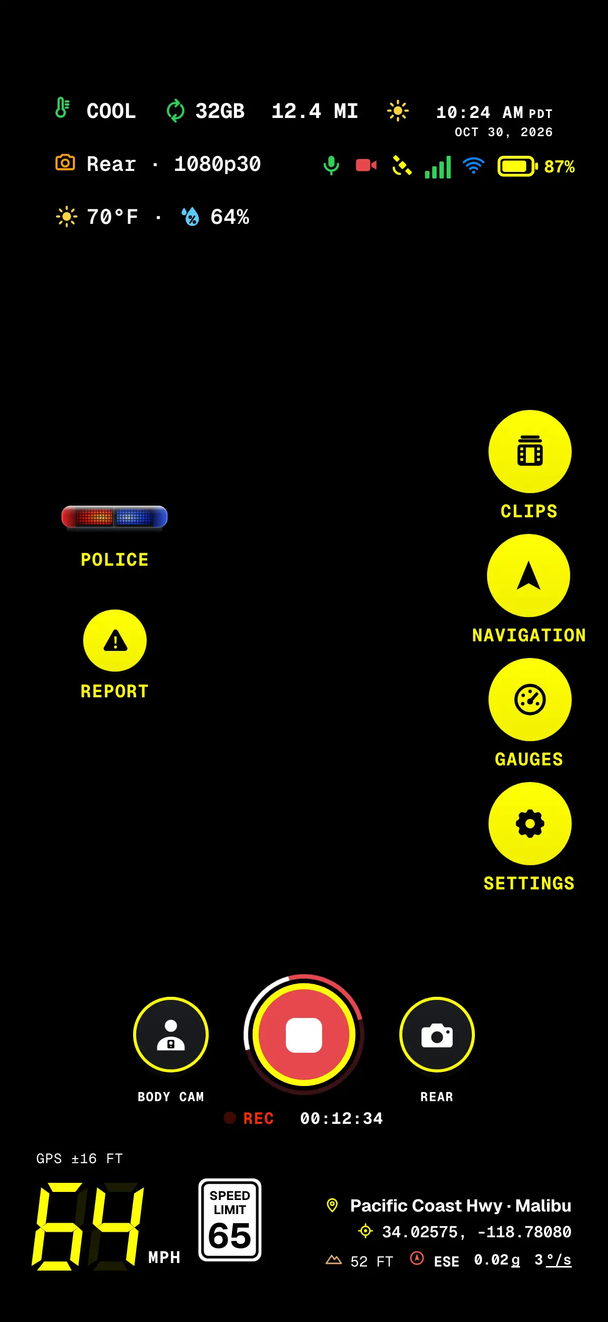
- Heat, space, tripThe phone's heat, the loop space in use and the miles this trip.
- Camera & weatherThe camera and quality recording, then the temperature and humidity.
- POLICEOne tap starts a police stop.
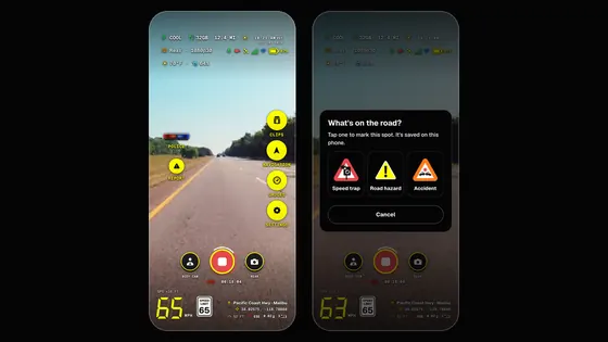
- REPORTMark a speed trap, a hazard or an accident.
- REC & clip clockRecording, and how long this recording has run.
- Speed & limitSeven-segment digits, with the posted limit beside them.
- Clock & dateWith the time zone: what's stamped on the video.
- Time of dayA sun or a moon; after sunset the words turn yellow.
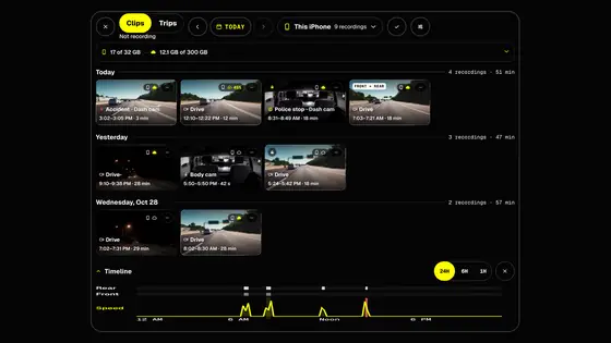
- The railClips, Navigation, Gauges and Settings, one tap away.
- Street & headingLooked up on the phone, with the coordinates, elevation and heading.
Dashivo's camera screen with sample data. The road behind it is added for this page; in the app it's your camera.
What's on it
- Speed
- Big seven-segment digits in mph or km/h, three from 100 up, with the GPS accuracy above them. Or plain white numerals: Settings › Units & clock.
- The limit
- The posted limit from OpenStreetMap: the white sign in mph, the round red-rimmed sign in km/h. No sign where no limit is recorded.
- 30 days
- Roads it has looked up stay on the phone for 30 days, and the next stretch ahead is fetched early, so a familiar drive works without signal.
- G-force and rotation
- Two readings after the heading: G-force for every bump and brake, and how fast the vehicle turns, in °/s.
- Trip
- Miles this trip, from GPS, in the top row.
- Where
- The street and city from the phone's own map service, the coordinates, the elevation and the heading. Coordinates are saved with every clip either way.
- Clock
- The time with its time zone, and the date, as stamped on the video.
- Weather
- The temperature and humidity, under the camera that's recording.
- Status
- The phone's heat level, the loop space in use, and icons for the microphone, the camera, GPS, signal, Wi-Fi and battery.
- The rail
- Clips, Navigation, Gauges and Settings, with POLICE, REPORT and, when you're stopped, PARK on the other side.
For the speed-limit sign, the phone asks Dashivo's own map server, built from OpenStreetMap, for the roads in the square kilometre around you, so no outside service sees where you are. Street and city names come from your phone's own map service.
On screen, or in the video
- The HUD, on screen
Speed, the limit sign, G-force and rotation, the trip, where you are, the clock, the weather, the phone's status and the buttons. For you, while you drive. Never recorded.
Settings › On screen: hide the readouts you don't need - The stamp, in the video
REC, the date and time, the weather, where you were, speed and the limit sign, G-force, rotation, trip and the recording's evidence ID, burned into every frame. You choose which. It shows in any player and when you share a clip.
Settings › Video › Stamp on the video
How it works
- 01
Mount the phone and tap record. The HUD comes up over the camera picture, upright or sideways.
- 02
As you drive, the sign beside your speed follows the road you're on, and rings red past the limit plus 5 mph.
- 03
Tap Clips, Navigation, Gauges or Settings on the rail, or POLICE and REPORT, without stopping the recording.
- 04
Hide readouts in Settings › On screen, or tap the picture and choose Picture off to keep the phone cooler.
Where it stands
Works today
- The HUD upright and sideways, on iPhone and Android
- The speed-limit sign from OpenStreetMap, kept on the phone for 30 days
- A black shadow on every readout, stronger over bright scenes
- On Android: the next turn from your navigation app
Coming soon
- Reports from other drivers within a mile ahead, with Dashivo Cloud
Your speed,
and the limit.
The sign shows the posted limit for the road you're on, from OpenStreetMap. It rings red when you're more than 5 mph (8 km/h) over, and where no limit is recorded there's no sign at all.
Try it
Move your speed, switch to km/h, or drive a road with no limit recorded.
At or under the 45 mph limit: the sign stays plain.
It's a guide: the signs on the road always come first. OpenStreetMap is a free map kept up by volunteers, so a limit can be missing or out of date.
A shadow for the
bright bits.
Every letter and icon on the HUD carries a black shadow: a tight edge and a soft glow, with nothing boxed in. Dashivo watches how bright the picture is behind each readout: over a bright sky or a white car the shadow grows stronger, and on a dark road it fades to a faint edge. It changes gently, so passing lights don't make it flicker.
- Heat, space, tripOver a bright sky, the shadow around the letters grows stronger.
- Camera & weatherThe rows below carry the same shadow.
- POLICE & REPORTTheir labels carry the shadow too, with no backing.
- Speed & limitOver a dark road the shadow fades to a faint edge.
- Clock & dateIts shadow is strongest while the sky behind it is bright.
- The railRound yellow buttons with black icons that read over anything.
- Street & cityWhite with a black shadow, readable over the road.
Dashivo's camera screen with sample data, over a licensed road clip.
 Coming