For iPhone & Android
App
HUD & speed limits
Your speed, the posted limit, G-force and where you are.
Everything Dashivo™ knows while you drive sits around the edge of the picture: your speed with the posted limit beside it, G-force, this trip and today, the street and city, the clock and the phone's own status. The HUD is for you and is never recorded; the stamp carries the facts into the video.
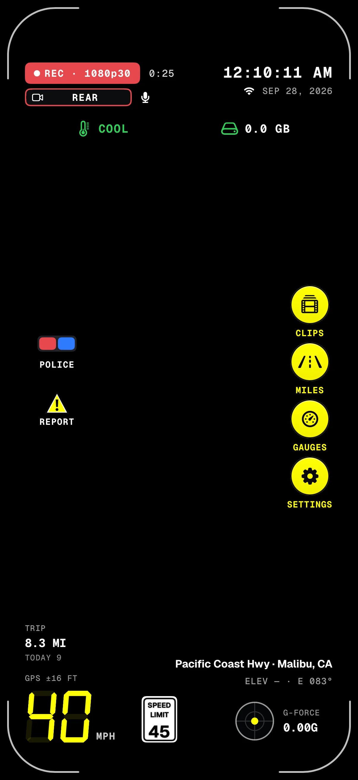
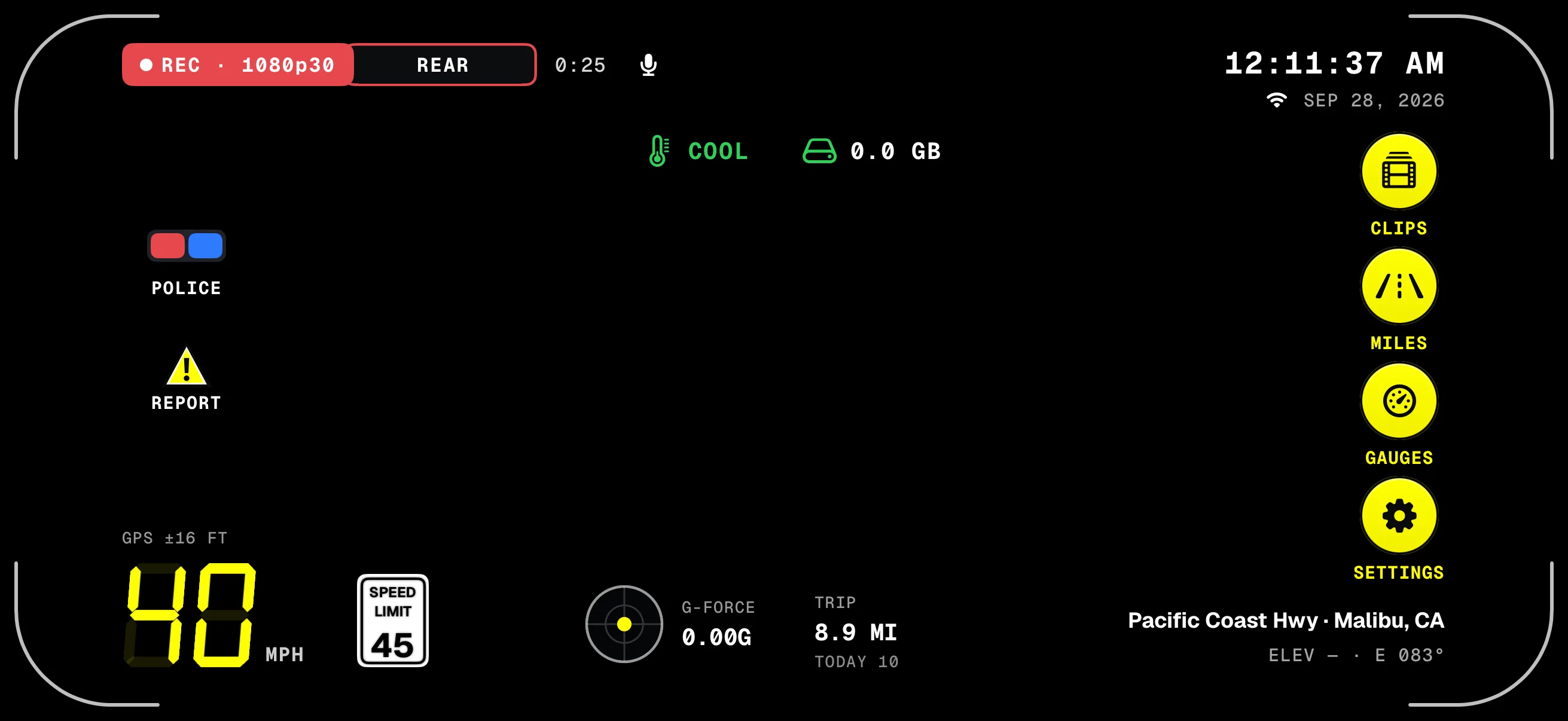
- REC & clip clockRecording, 4K or Full HD, and how long this recording has run.
- POLICEOne tap starts a police stop.
- REPORTMark a speed trap, a hazard or an accident.
- Trip & todayMiles this trip and since midnight, from GPS.
- Speed & limitBig digits, three from 100 up, and the posted limit beside them.
- Clock & dateMonth, day and year: what's stamped on the video.
- The railClips, Miles, Gauges and Settings, one tap away.
- Street & headingLooked up on the phone, with elevation and heading.
Screens from the iPhone app on a simulated drive. The road behind them is added for this page; in the app it's your camera.
What's on it
- Speed
- Big seven-segment digits in mph or km/h, three from 100 up, with the GPS accuracy above them.
- The limit
- The posted limit from OpenStreetMap: the white sign in mph, the round red-rimmed sign in km/h. No sign where no limit is recorded.
- 30 days
- Roads it has looked up stay on the phone for 30 days, and the next stretch ahead is fetched early, so a familiar drive works without signal.
- G-force
- A small meter and a reading, for every bump, brake and turn.
- Trip & today
- Miles this trip and since midnight, from GPS.
- Where
- The street and city from the phone's own map service, or coordinates. Coordinates are saved with every clip either way.
- Clock
- The time and the date, month, day and year, as stamped on the video.
- Status
- The phone's heat level, uploads waiting and the storage Dashivo is using.
- The rail
- Clips, Miles, Gauges and Settings, with POLICE and REPORT on the other side.
The speed-limit sign asks OpenStreetMap's public servers for the roads around you, using an approximate location; street and city names come from your phone's own map service. None of it is sent to us.
On screen, or in the video
- The HUD, on screen
Speed, the limit sign, G-force, trip and today, where you are, the clock, heat, uploads, storage and the buttons. For you, while you drive. Never recorded.
Settings › On screen: turn any readout off - The stamp, in the video
REC, the date and time, where you were, speed, G-force and trip, burned into every frame. You choose which. It shows in any player and when you share a clip.
Settings › Video › Stamp on the video
How it works
- 01
Mount the phone and tap record. The HUD comes up over the camera picture, upright or sideways.
- 02
As you drive, the sign beside your speed follows the road you're on, and rings red past the limit plus 5 mph.
- 03
Tap Clips, Miles, Gauges or Settings on the rail, or POLICE and REPORT, without stopping the recording.
- 04
Hide any readout in Settings › On screen, or turn the camera picture off to keep the phone cooler.
Where it stands
Works today
- The HUD upright and sideways, on iPhone and Android
- The speed-limit sign from OpenStreetMap, kept on the phone for 30 days
- A black shadow on every readout, stronger over bright scenes
- On Android: the next turn from your navigation app
Coming soon
- Reports from other drivers within a mile ahead, with Dashivo Cloud
Your speed,
and the limit.
The sign shows the posted limit for the road you're on, from OpenStreetMap. It rings red when you're more than 5 mph (8 km/h) over, and where no limit is recorded there's no sign at all.
Try it
Move your speed, switch to km/h, or drive a road with no limit recorded.
At or under the 45 mph limit: the sign stays plain.
It's a guide: the signs on the road always come first. OpenStreetMap is a free map kept up by volunteers, so a limit can be missing or out of date.
A shadow for the
bright bits.
Every letter and icon on the HUD carries a black shadow: a tight edge and a soft glow, with nothing boxed in. Dashivo watches how bright the picture is behind each readout: over a bright sky or a white car the shadow grows stronger, and on a dark road it fades to a faint edge. It changes gently, so passing lights don't make it flicker.
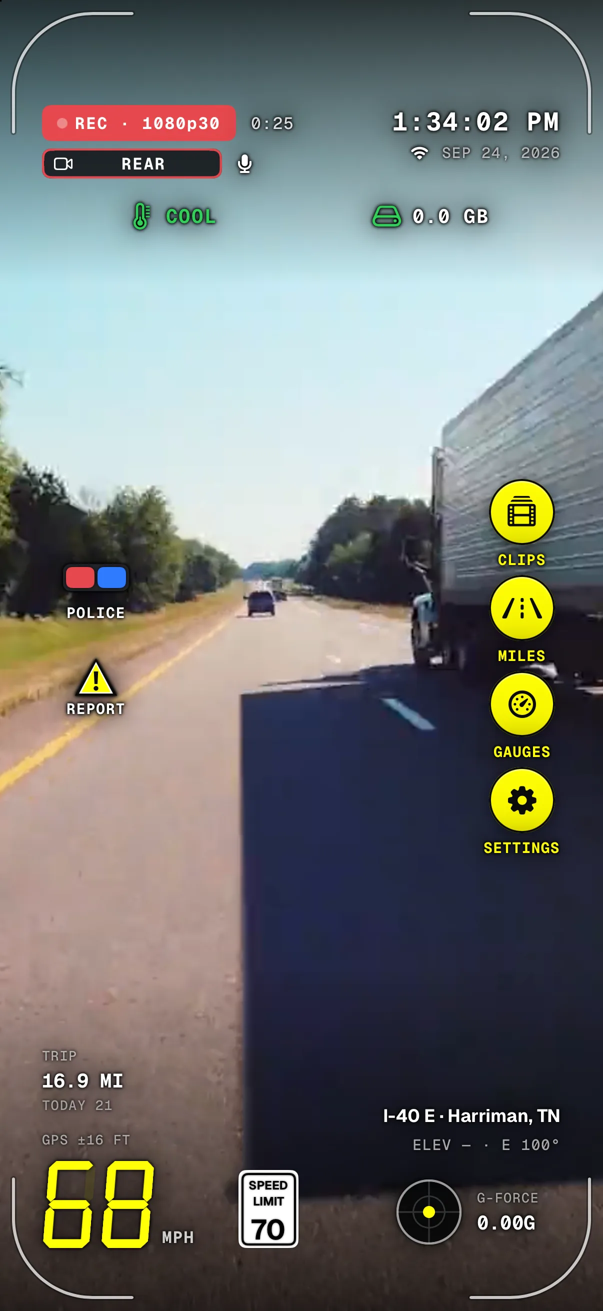
- REC and the clip clockOver a bright sky, the shadow around the letters grows stronger.
- Heat, uploads, storageThe status row carries the same shadow.
- POLICE & REPORTTheir labels carry the shadow too, with no backing.
- Speed & limitOver a dark road the shadow fades to a faint edge.
- Clock & dateIts shadow is strongest while the sky behind it is bright.
- The railRound yellow buttons with black icons that read over anything.
- Street & cityWhite with a black shadow, readable over the road.
A screen from the iPhone app on a simulated drive, with a licensed road clip played as the camera for the capture.
More of the app
Download
Drive with a
witness.
Dashivo™ is free for iPhone and Android. Get the app, mount your phone, and your next drive is on the record.
Nothing new to buy · No account needed · Footage stays on your phone